
It was early in April when I came across a flyer for "Get Lost", the debut bikepacking event organized by Richmond's own; Journeyman's Adventure Co. Without question, I knew this was something I needed to do. The event offered a self guided route with a 100 or 200 mile option, both starting and ending at Journeyman's storefront in Church Hill.

First things first, I needed to get a bike. After a handful of shop visits, and plenty of research over the years. I decided on the Surly Disk Trucker. With the intent to eventually do an extended tour across the US, this bike really seems to cover all the bases. Surly put a lot of thought into this model after generations of tweaking and fine tuning. I was super excited to put it to the test, and was beyond impressed to discover how well it performed. The function and durability of this bike far exceeded my expectations.
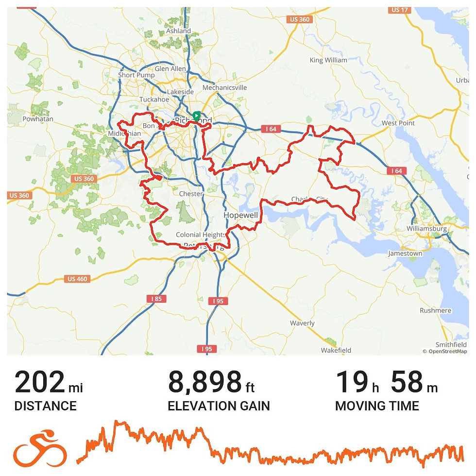
I originally intended to complete the 200 miles over the course of 3 or 4 days, camping along the way. In the thrill of it, I ended up completing the loop in 31 hours.
In this post I'll share with you my setup, some finer details of the course, and various thoughts and insights I discovered along the way. My hope is that this entry may help to inspire anyone with an interest in bikepacking. With so many advancements and increased desires for a bikeable America, now is as good of a time as ever to get pedalling. Going forward, I really hope to see more of these events happen around the Richmond area and beyond.
Rig Rundown:

I introduce to you, Miss Mandy Lynn.
I had about a month to toy around with bags and fittings. First and foremost was the frame bag. Glenn at Journeyman's fitted me with this waterproof bag from Revelate Designs. On one side I have enough space to fit my camping hammock. The other side has some easy to reach compartments that are a perfect fit for my phone, keys, and wallet. Leaving a little extra room for cliff bars or snacks.
Next was my cup holder. Journeyman's proudly carries these handmade bags from Jack's Sack's, a local company made here in RVA. This bag really came in handy, it's basically a giant cup holder that's large enough to tuck away a Nalgene. Not only was my water in close reach, but I was also able to clip my speaker without any fuss. There are some smaller mesh compartments surrounding it, and the splash of pink is super cute and perks up my spirits everytime I see it :)
The day before the ride I decided to throw on the back rack, which was previously fitted on my city bike. The saddlebag, combo thing, is from Topeak. The bag itself is a little cumbersome and a little difficult to take off, especially when it's full. It also isn't waterproof which is a big downside. All of this aside, it's been a huge help over the years. I really couldn't have asked for a better starter bag. I plan on swapping this out for something more practical down the road. Especially when the time comes for extended touring. As for the purposes of this trip, I am so glad I decided to put it on. It gave me so much room to fit my clothes, U lock, extra snacks, and charging cables.
There's still a lot more I would like to fit onto her. With so many setups to try these days, I really look forward to experimenting with more options and seeing what works best with me. I figured I had more than enough space for our first big trip. As it turns out, I could have definitely packed a lot lighter.
Item List:
Hennessy Pro Lite Hammock
JBL Clip speaker
various charging cables
Clothes: Sweater, Throw Jacket (blanket), 2 shirts, 2 pants, 2 pairs of underwear, 3 pairs of socks, hat
220 Niterider Cycling light
Planet Bike Superflash back light
500 Black Diamond Headlamp
basic patch kit
Travel Pump (defunct)
Dried Mango Slices
Various Protein Bars
Nalgene
Cycling bottle
U lock
phone, keys, wallet
Wahoo GPS
Toothbrush/paste
Rain Cover
Disclaimer: This is not a monetized post. I am not sponsored, nor am I receiving any funding from the businesses/manufacturers mentioned in this post.
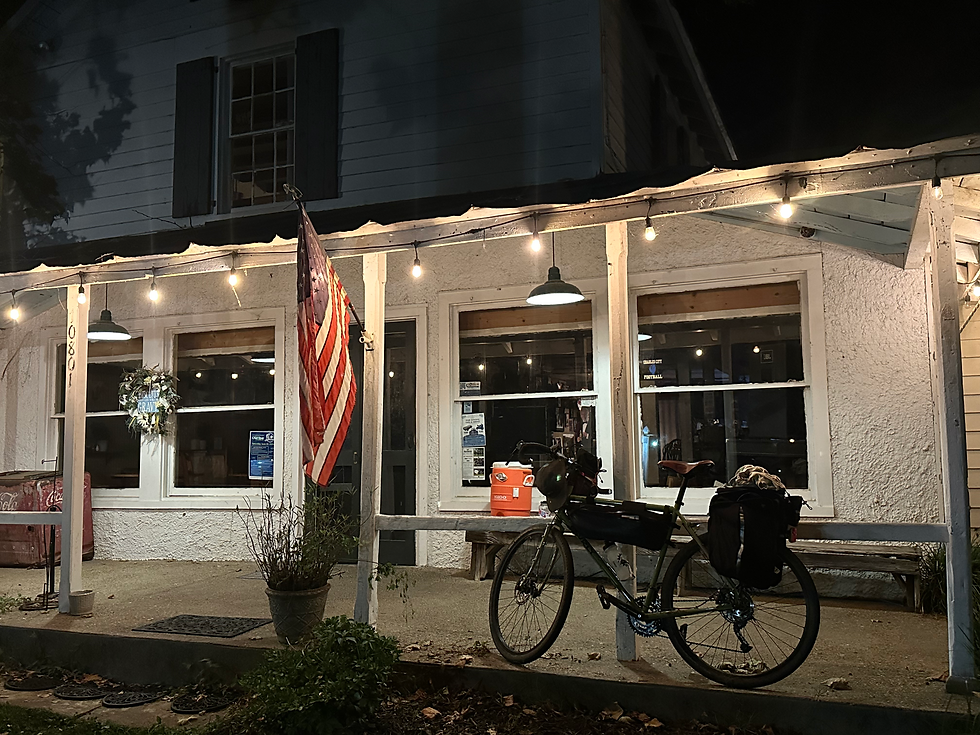
The Rendezvous:
I pulled up to Journeyman's at 5am. Glenn greeted me with a smile as he was setting up a coffee table, and quickly noticed that I was without a GPS. With this being my first lengthy ride, I was totally unaware of how helpful that would be... I had the route downloaded to my phone via RideGPS, which I intended to use for directions. Little did I know that I would've spent a whole lot of time lost and frustrated if that was my only means of navigation (Having to stop and pull out my phone every 5 minutes would've been a nightmare). Fortunately, Glenn had a spare GPS that he was happy to let me borrow. He was quick to install the headset, and had already loaded the route to the little device. It took a solid 15 minutes for it to buffer, but thankfully the route loaded up without fail. This little guy became the most crucial companion for the remainder of the Journey. I honestly wouldn't have been able to complete the ride without it. So a big "THANK YOU" to Glenn for the set up.
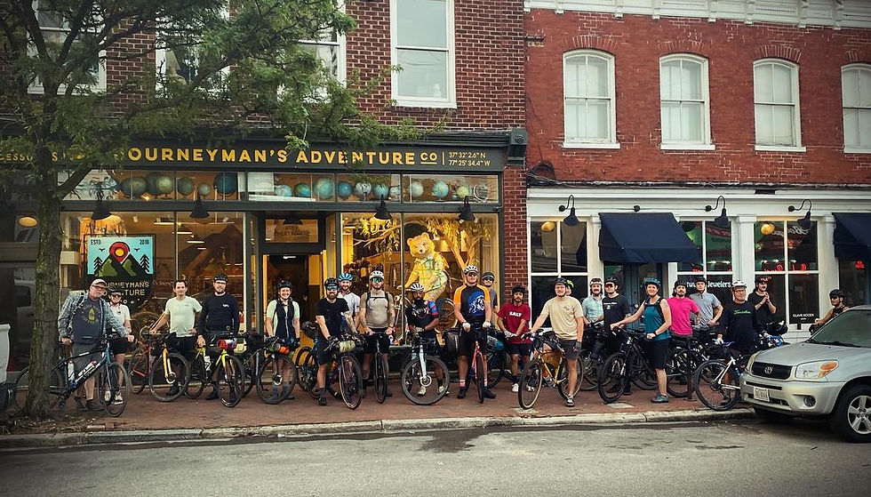
The other participants began to roll in around 5:30. It was so inspiring to see everyones bikes all packed up and ready to go. Every bikepacker has their own style and essentials, and it's always fun to see how peoples bikes match their personalities. I was stoked to see some familiar faces, but for the most part I was in the presence of a new group of soon to be friends. Glenn made us coffee, and provided bananas and tangerines for a quick breakfast.
It was here where I met a fellow cyclist who had already done a few month tour across the country. He said it was the most worthwhile thing he's ever done, and shared some very inspirational words and advice with me. There's something so stoic and genuine about distance cyclists. You can tell that they really mean what they say. Though our conversation was pretty brief, it left me more inspired than ever to get started on a tour of my own.
Before we knew it 6am began to roll around, so we gathered together for this group photo:
I really had no idea what to expect. I knew I had some long days ahead, but in this moment everything felt all too real. This was it. I'm actually doing this...
Glenn gave us a little pep talk before telling us all to "get lost"
The Ride:
We set off as a peloton, gliding our way through downtown Richmond before maneuvering into the canal walk towards Brown's Island. What a great way to start the trip. This small introduction was all too familiar. I've spent many days walking, running, and biking through these areas. However, this was the first time I've ever done it with such a large group. We crossed over the Belle Isle pedestrian bridge and made our way into the James River Park System. I was immediately impressed with how Mandy was handling it. Even with all of the weight I packed on, she slid through the terrain with great ease.
I was taken aback by all of the scenery. It was a headspace that I haven't experienced for quite some time. I was getting flashbacks to my first distanced ride that I took back in my middle school days. The sensation was all too familiar, yet all too distant. It was really great to be back in it.
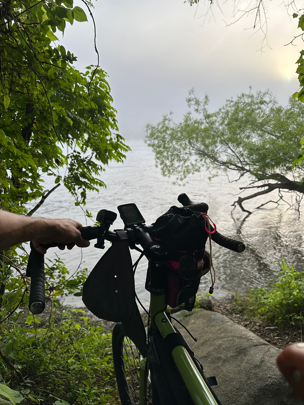
At one point we passed by a massive snapping turtle trudging across our path. At that moment, I knew I was in for it. Spiritually, the snapping turtle holds many meanings. In some traditions they symbolize the completion of a long journey, marking the finality of a previous time which once held you back. Now, the snapper invites you into a new chapter. Void of ways that were once a hinderance. In more modern traditions, they serve as a reminder to take your time and be more deliberate. Shortly after passing this old friend, I looked out and noticed the fog rolling over the James. In this moment I was overtaken by a strong feeling of accomplishment, It was going to be a good day. Thank you for the visit Mr. Snapping Turtle.
We made it to the Nickel Bridge, were we climbed a switch back to get onto River Road. There, we made our way through some of Richmond's most sought after real estate. Embracing the glorious downhills, and tackling the uphill climbs with a strong starting pace. It was around here where I discovered a helpful little easter egg. I was approaching a hill and all of a sudden the GPS beeped at me and said "CLIMB!". I was super confused. Was this thing broken? what am I supposed to do? Well, I guess I'll climb?
My first thoughts where that this notification was pretty dumb. Like, obviously, there's a big hill ahead of me. However, this handy little function turned out to be incredibly useful. In addition to the heads up it provided, it also displayed the curve of the incline and the amount of distance I had left to go. Hills can be kind of deceiving, and having that display really helped me judge when to switch gears to keep my pace. It also timed all of the climbs, pretty nifty. Lastly, it was always a great feeling after reaching the top when it announced "SUMMIT!" Super cute :)
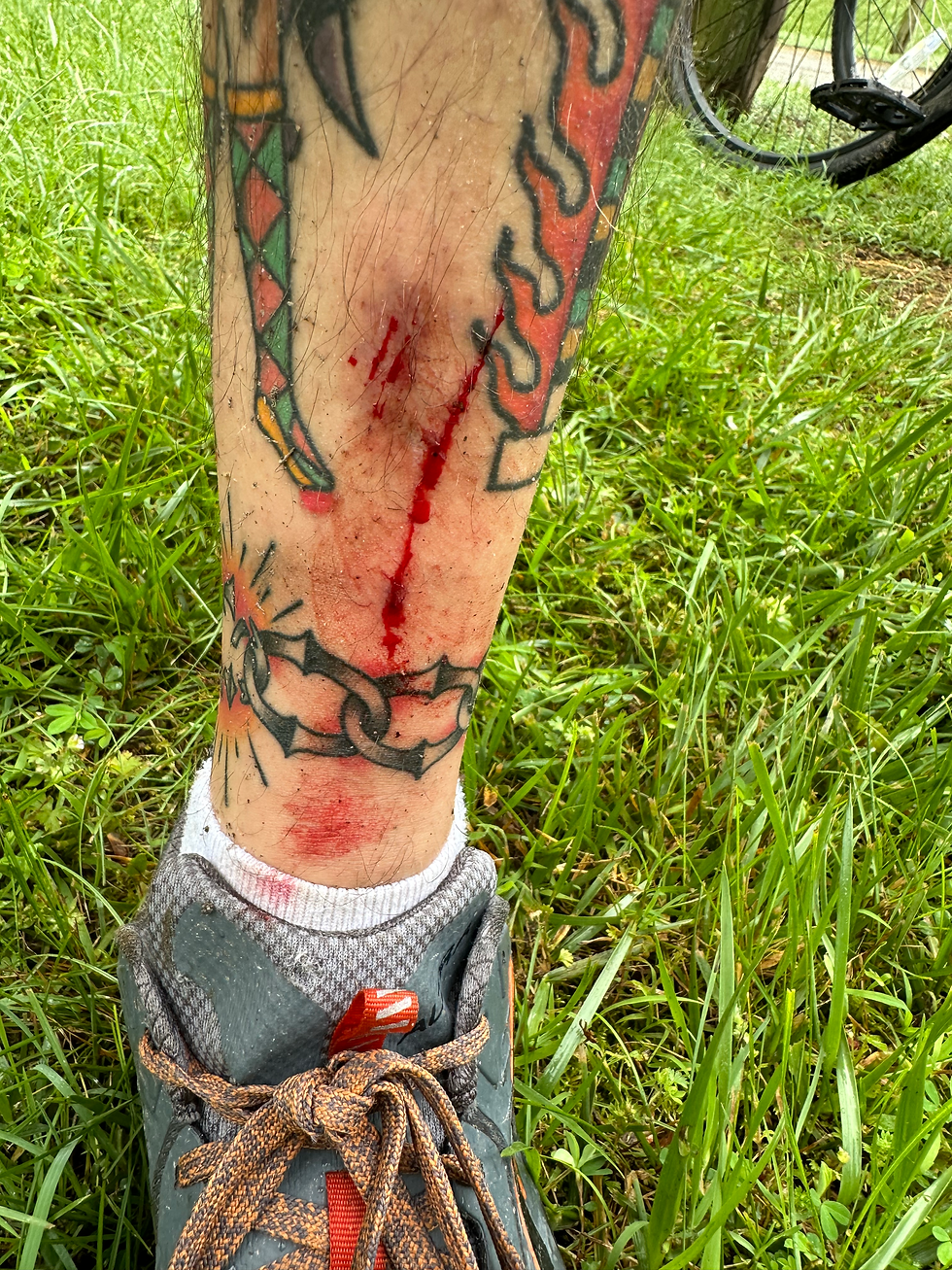
As we got deeper into the suburbs of Forest Hill our route continued to dabble more and more into the sprawling trail systems. I was beyond impressed to see how many trails we have so close to home. With this initial excitement, I hit them a little too aggressively and ended up flying off the path. Luckily I didn't fall, but my bike ended up crashing straight into a tree. The spikes on my pedals dug deep into my leg, and I gnashed up my shins pretty good. I was lucky to still be standing, and thankfully my bike took it without any damage. We were only about 12 miles into the ride, and that would've been such a bummer to have ended so early...
We got out the woodwork and found ourselves in a park where we took our first break. We drank some water and ate some snacks. The group I was with was doing a leisurely trip of the 100 mile, and planned to set up camp at Pocahontas State Park. I thought of maybe joining them, depending on how the day went. Group camping trips are always a blast, and they seemed like a really fun group. However, I still had a long way to go. I was really itching to get at least the halfway before setting up camp. Now that the momentum had started, I was beginning to feel ambitious about how many miles I could pack into the day. So with all of this in mind, I wished them well and continued on. For the rest of the trip I spent the majority by myself.
While biking through Midlothian I was super pleased with how well maintained the course was. The route took us through a bunch of quiet and well kept suburban neighborhoods. Along with some super upscale areas, which I had no idea existed. The traffic was very polite and kept their distance in a very safe manner. I honestly felt very comfortable and safe biking through this area. The roads were super smooth, and I enjoyed winding through the hills that Virginia is so famous for. I was also thrilled with how many wood trails the area still had to offer. I knew there was a good amount while I was scoping the course on the internet, but I had no idea it would be to this extent.
About 30 miles in I began to crave some nourishment. I was told that there would be plenty of stops along the way to restock on snacks and beverages. Knowing this I didn't pack much food or any of my cookware. As the day was still pretty young, I kept going until I reached Midlothian Mines Park. I was fortunate to run into a fellow cyclist and we stopped for a quick lunch.

We soon became friends, and shared a handful of miles together. She was attempting the 100 mile, and had plans to meet a friend for a late lunch in Petersburg. She also had a friend in a car nearby in case something went wrong. Knowing that I had twice the distance and that she had some support closeby, we decided to part ways and say our farewells.
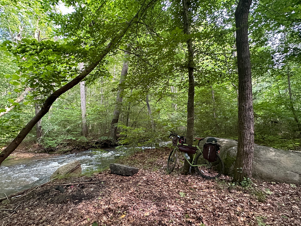
The route continued with more of the same suburban sprawl, with some small busy highways scattered about. Lot's of churches and strip malls. Nothing all that exciting until I got to Pocahontas State Park. This was easily one of my most enjoyed sections of the day. The majority was ridden on gravel fire roads, and my bike was so happy about it. Mandy just ate it up without difficulty. I could've stayed on those gravel roads for days, and I definitely plan to do just that in the near future.
I took my first extended break at the visitor center, they had plenty of tree shaded picnic tables that were fixed with outlets. It was here that I was pleased to discover how quickly the GPS took a charge. I was about 46 miles into the ride, and my legs were starting to feel it. It was also the hottest part of the day, so I thought it best to cool off for a bit. Especially without knowing how much shade would be provided the rest of the way. It was a nice and relaxing break, and I enjoyed exploring more of what the park had to offer.

After getting charged and rested, I continued on to my least favorite section of the ride. The route from Pocahontas to Petersburg was pretty grueling. It was hot, there wasn't much shade, and the shoulder was little to none. This was also the most unwelcoming traffic that I encountered. As I was biking down Route 602 towards Matoaca I almost got hit by a boat trailer. It was also the only time someone honked at me while passing (without moving lanes). "What a loser" I thought as I cheerfully waved back at them. I was sure to have my flashers on to best be seen. I just don't think this area was very accustomed to having cyclists around. Needless to say, I don't think I'll be biking through this area again anytime soon.
As I was making my way, I saw my friend whom I rode with earlier. She was stopped by the side of the road. Fortunately she was OK and not hurt, she just decided to call it quits due to the rude traffic. I can't say that I blame her for that. We talked for a little while as the cars continued to zoom by. She already had her friend on the way to come pick her up, so we wished each other well and I continued on. A few miles down the road they passed by and waved while cheering me on. That's what it's all about 🎉
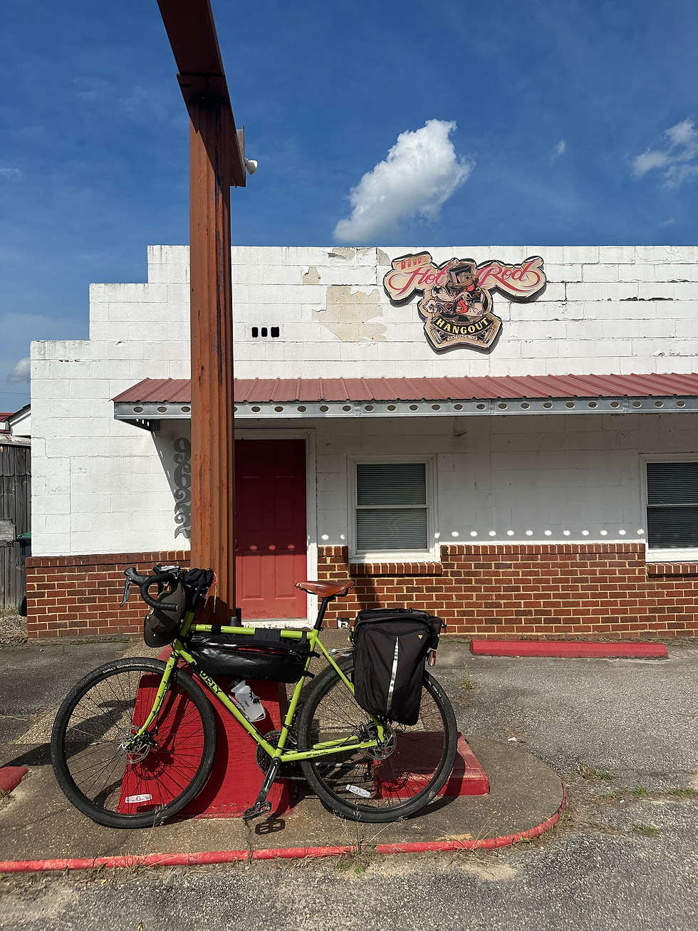
Although this was my least favorite part of the ride, there was still a silver lining. My favorite part was passing by this old hot rod hangout. Soon after I passed it, a funeral procession came towards me on the opposite side of the road. With it was a trail of some of the most well tuned hot rods I had ever seen. It made me long for that kind of community. Traveling the country in a souped up stunner with some good friends sounds like a blast. I guess I'm kinda doing the same thing, just at a much slower pace 😉
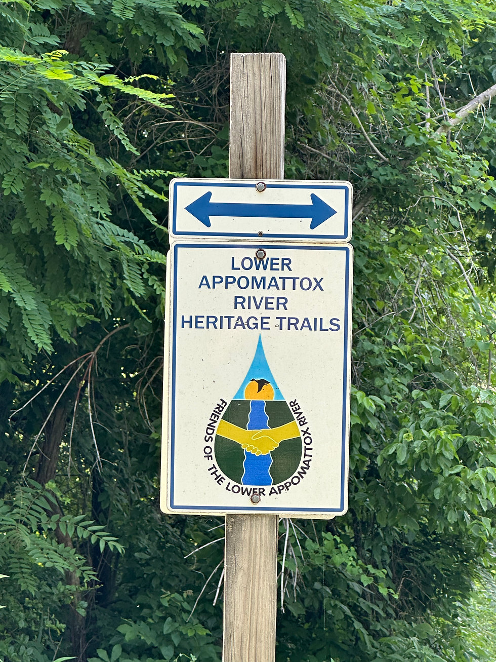
The little cross section from Matoaca to Colonial Heights was pretty pleasant. I was glad to be back in some tree coverage, and the GPS showed I would be following a river for a while before entering Petersburg. I was super stoked to see this sign as I entered the last major trail section of the ride.
What started out as a super relaxing gravel road, soon turned into an infuriating puzzle. We were forewarned that parts of the route may need to be adapted due to forces out of our control. The GPS also had a tendency to be a little misleading at times. Well aware of these factors, I ended up overthinking this section a little too much. But hey, no pain no gain right?

I jumbled my bike over some train tracks and unkempt vegetation. There were some pretty clear indications about which way to go, but I ended up back tracking a few times just to be certain. I ended up pushing my bike up and down the same steep hill a couple times before discovering the bridge I needed to cross... Man did I feel dumb. Eventually, I found the correct route... But, I was pretty mad. The notes on the RideGPS mentioned that this could be a good spot for stealth camping, and it was pretty tempting. But being in such unfamiliar territory mixed with the adrenaline of heaving my bike back and forth made me just want to get out of there. I will admit though, this would've been a pretty cozy spot.
The route continued as an unmarked trail which led to a trainbridge. It took me a while to visualize just how to make it to where I needed to go. I ended up finding a small detour to make it happen, as the "planned route" was obstructed by some large equipment that I didn't feel comfortable crossing. I made my way around, and found myself back on the route without much delay. I was now in good ol' Petersburg.
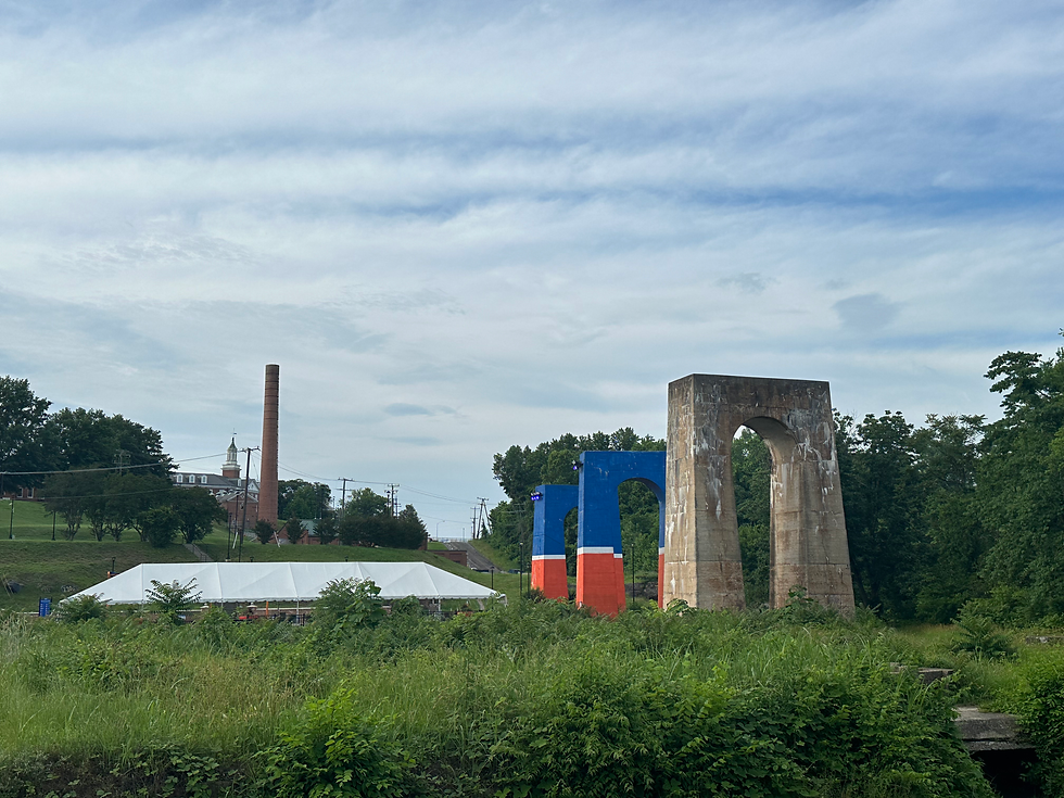
After sailing through some communal parks and local river spots, I made my way through old town. I was thrilled to find a familiar BBQ joint close by, where I stopped to enjoy a pint and a brisket sandwich.
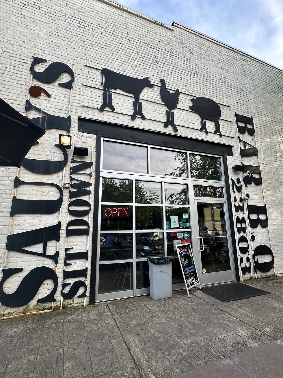
It was during this stop that I began to realize I'd most likely be doing this trek in full. At this point I'd already gone about 76 miles. Previously, my longest day in the saddle was 56. A big factor in wanting to finish was charging my devices. I really didn't want to have to turn off the GPS in fear of losing all of the progress I'd made thus far. That would have been detrimental to say the least. Plus, I had no clue of how my cell service would fair through the next sections. So as I ate, I started to plan out the rest of my ride. Fortunately, It appeared that the worst was over... Or so I hoped... it all seemed doable at least. I took my time to enjoy the BBQ and rest my legs. I think by this point, my only regret was not getting a second sandwich.
Leaving Petersburg was a bit melancholy. If you've ever spent some time in the outskirts, I think you know what I mean. As I passed by the motels and beat up gas stations I decided to stop for a pack of cigarettes. I'm really glad I did honestly. In a way I felt a bit defeated, as I was really hoping for this ride to mark a solid quit date for me. The cigarettes actually came in handy going forward. They helped me to maintain some kind of sanity, as well as keep me awake in moments where I really felt drained. It's an old habit, if you know you know. I would never recommend for anyone to pick up smoking. For the purposes of this ride they helped me power through, but at what cost? Going forward I think it's safe to say I'll be better prepared to not require this crutch.
The sun was beginning to set as I turned into the historic Petersburg National Battlefield Park. I was actually a bit surprised, as I had never visited before. It's no secret that Virginia is home to a lot of painful history. As I rode through the fields I couldn't help but feel overtaken by an overwhelming state of reverence. This was one of many parts of the ride that helped me realize the varying significance of where I'm from.
Upon leaving the battlefield I was then taken through the campus of Fort Gregg-Adams, an active army/military base. Riding through the base was very sobering. As it was getting late there wasn't much activity, but there's just something about military bases that give me the creeps. Something about the dichotomy of the training obstacles right next to the golf course just doesn't sit well with me. Not even to mention the state correctional facility right down the street... But I digress. As I made my way through the bases housing areas I was pleased to see a bunch of kids playing on their bikes and scooters. That gives me a little hope at least...
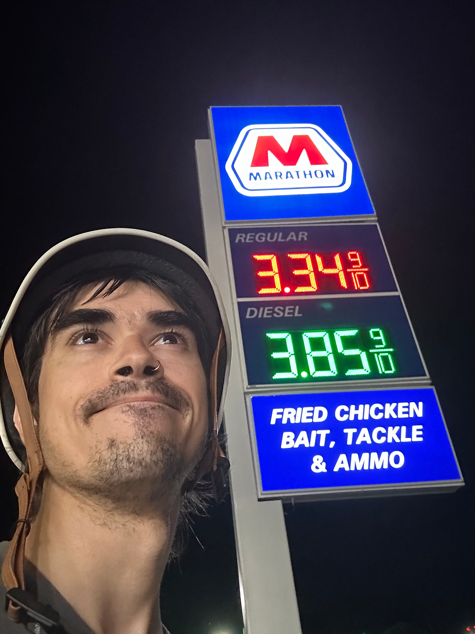
I made my way into Hopewell and found myself posted up at a Wawa, where I charged my devices and got some coffee. *Pro Tip* gas stations usually have an active outlet on the exterior of the building (look near the ice machine). I remember talking on the phone with some friends and family at this point.
"YOU BIKED TO WHERE?!?!" 😂
Too late. Miles to go. I'll be fine, I promise.
It was dark at this point, so my journey onward was made with much caution. Luckily, I only had a small stretch of busy roads until I landed back in the country. This last stretch of highway was very spacious, and I'm very grateful that each passerby was extremely respectful as I made my way through the dark. Although the miles that led to this bridge were pretty empty. Being as I was alone and on a bike and all, it was still a little scary. Marked in the notes on the GPS was a very busy intersection leading to the Benjamin Harrison Memorial Bridge. So I figured doing this stretch around 10pm would be a good idea to stay out of traffics way. In hindsight, I think that was a very good call. As I was crossing the bridge, I was essentially the only passenger. A few work vehicles passed, and were very polite to give me ample space. But Man! what a view that was... I wish I could've stopped to take a picture.
After crossing the bridge, I was back in familiar territory. Up next was a 19 mile stretch on the Capital Trail, a bike path that follows Route 5 from Richmond to Jamestown. I entered the Cap right before the Berkeley Plantation, and enjoyed the ride as I entered Charles City. There, I took a much needed break. I rested up at the Charles City Courthouse Grill, where I was thrilled to find a cooler filled with chilled water, a bike pump, and plenty of outlets. They also had a portapotty out back. I was living pretty large.
I helped myself to some water and charged my devices. I spent about an hour and a half, reminiscing on all of the miles covered and all that I still had left to go. The last time I was at this grill I was only about 25 miles in while on my way to Williamsburg. Charles city is considered to be the halfway point on the Capital trail, and this spot is pretty famous as a biking destination. For this ride, I was about 115 miles in, with only 85 miles left to go. I was officially passed the halfway mark! Funny how things be like that sometimes. After I got my phone to a full charge I decided it was time to press on.
The rest of the stretch on the Capital Trail was like a dream. I coasted almost effortlessly through the landscape. Enjoying the millions of fireflies that lit up the trees in the distance. It was so peaceful, there was no one around for miles, and I just enjoyed my solitude in the silence. At this point it felt like my bike was basically riding itself, and before I even had the chance to realize it, it was time to turn off for the next stretch.
I continued the next 40 miles or so in a similar dream like state. Rarely did any cars pass, as it was already 1:30 in the morning. I just kept winding up and down the back country roads, and at a surprisingly fast pace. Being that I was guided by a pretty dim light, I couldn't see very far ahead of me. This is when I learned a good deal about pacing. Since I was only able to see the small stretch ahead of me, I was able to keep a much more even pace. Also, without the cars whizzing by, I didn't feel as if I was going any slower than I needed to be. I just kept churning through the farmlands and country homes until I made it into New Kent. My headlight only had about a 3 hour battery life, so I thought it wise to make one final charging stop.
It was here where I started to get very sleepy. It was a little chilly out, so I went ahead and put on my sweater. Big mistake. The comfort of my sweater in addition to the nicely furnished screened in gazebos I was passing almost did me in. I was honestly sooo close to laying down and napping on a nicely manicured lawn... I got a tip from some of the organizers that it's pretty safe to sleep out behind a church if you're in a pinch. I was super tempted to do just that, as I passed by a quaint little church tucked away in the hills. I figured at this point, I would hate myself too much to want to get back on my bike in the morning. So instead, I found a gravel cut off where I lit a cigarette and waited til sunrise. I took off my sweater and just stood there in the cold. Getting eaten by mosquitos, and thinking about how quickly I could make it home. Once sunrise finally rolled around, I heard some roosters crow off in the distance, and that was all that I needed. I was back in it.
Man, what beautiful morning. I would really like to go back and redo that section in the daytime. There were some really stellar downhills that I wasn't able to enjoy to the fullest extent given my lighting situation. But oh well, at least now I know where to find em.
I soon hit the 24 hour mark, when I realized I rode about 146 miles... Not only was that how much I've ever done in 24 hours, but that's also almost triple the amount I've done in a total trip... Might as well just close this thing out...
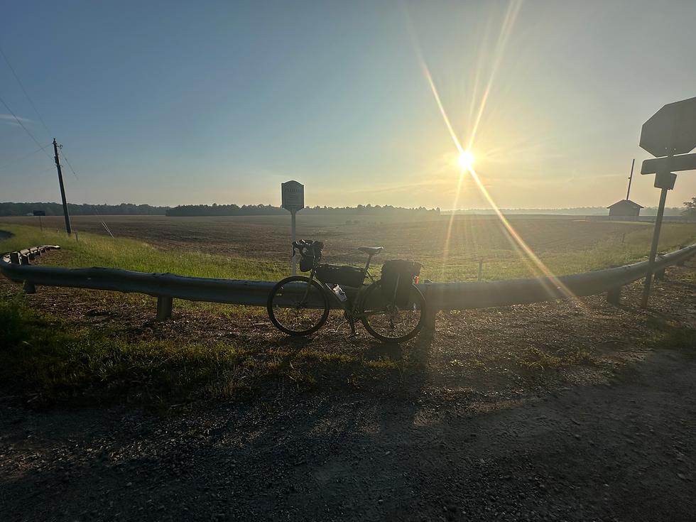
One of the most magical parts of the journey was riding along this gravel road around New Kent. I honestly couldn't imagine a better way to start the day...
The road continued to pass by these huge farm lands. There wasn't much shade to be found, and soon enough I was getting berated by the heat again. I was fortunate to find a little pit stop before my last 20 miles to get back home. I ate some zebra cakes, and pounded back a Frappucino while chatting it up with a local before making my final trek back to Richmond.
I was assuming that the ride home would be a breeze. I mean, they really put us through the ringer on this route. Before I even knew it, I took a turn, and BAM! I was back on the Cap trail. What?! How could I had never known that all these prime biking spots were so close to home?! That really got some gears turning for some future excursions.
I was really hoping the route would take the cap back to Richmond. Instead, I was in for yet another surprise. I was quickly diverted off of the Cap and down into some more farmlands. The road led to another historic state park which contained Fort Harrison and Fort Johnson. Again, I had no idea these parks existed so close to home. Had it not been so hot, and myself so exhausted. I would have loved to have spent more time exploring the historical markers. But being that I was only about 10 miles out, I was ready to make my final stretch home. One last easter egg before reentering Richmond proper was circling around the back of Hadad's lake. That brought back some very fond memories of years passed (check my first blog post).
Richmond has come such a long way when it comes to safe biking routes, but I must say I was very displeased to see how rude the traffic was along Osborne Turnpike. Multiple work vans were in very close proximity as they passed while not changing lanes. I mean, cool guys, hit me. At this point I don't really care. With the growing community of cyclists venturing out to that area, something seriously needs to be done about that. I've already been on a ride to set up a ghost bike on that stretch, and I can say with confidence that no one wants to go through that ever again. We've learned enough hard lessons on that front.
The last 5 miles will go down in history as some of the most masochistic insanity I have yet to put myself through. After bombing the biggest hill that Richmond has to offer, I then climbed all the way back to the top of Fulton hill and then bombed that as well. I then scrambled my way through some undisclosed train tracks and gravel yards where I climbed to the top of the Chimborazo lookout. Not on the front side mind you, but around the back cobble stoned walking path. Seriously. What the hell. I was already delusional at this point, but this little twist of fuckery was truly the work of a crazy person. Never in my life had I been so close to calling it quits. I was already 197 miles in, and these last 3 miles took me over an hour to navigate... At this point, all I could think was that I sure as hell was going to get this completion patch... Man... I will say that downhill from Chimborazo back to the shop was the most well deserved I will probably ever do. Quote me on that.
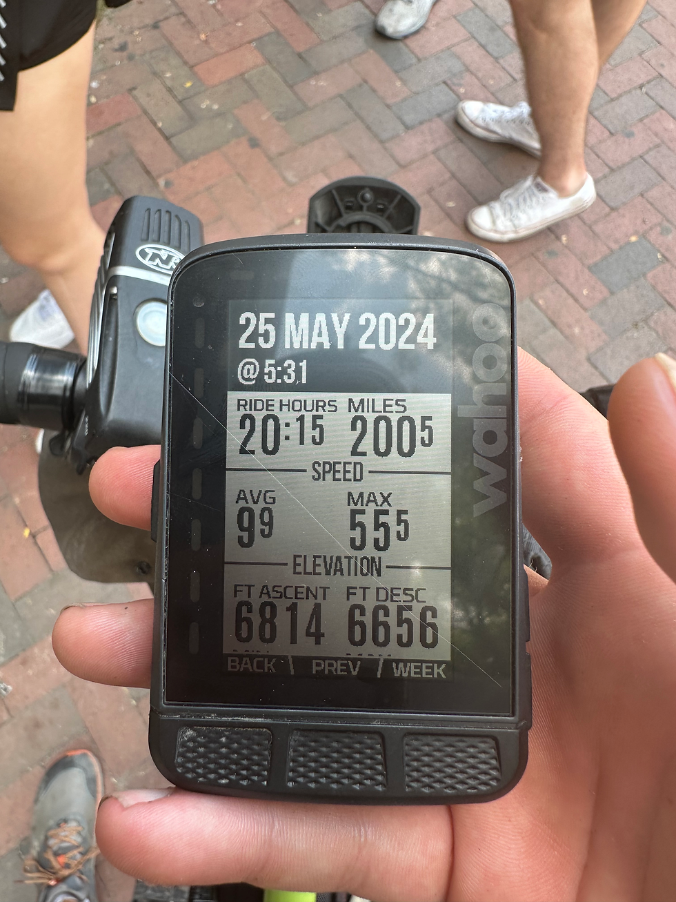
Finally, I made it back to homebase and clocked my time. I made it in just under 31 hours, with 20 of those hours actively riding my bike. Sweet, sweet victory. I then rode back to my apartment were I sat in delusion before crashing HARD for about 24 hours. I'd never been so tired in my entire life...
Conclusion:
Now that all is said and done, I would totally do this route again. Hopefully next time with some friends, while making a few overnight stops along the way. As much as I enjoyed doing all of this in one go, there are definitely some sections that I would like to savour a bit longer and maybe explore a bit further, especially in the New Kent area.
The ride as a whole was a dream come true. I cannot stress enough how well thought out this route was. Not only did I discover so much about what the area has to offer. This trip also helped to open my awareness on some fresh and inspiring possibilities. In addition, I made a deliberate plan and sought it through to completion, which is a huge personal victory. The biggest "thank you!" to Journeyman's for putting all of this together. Not only have you fostered a community for your mission, you have also developed an institution that helps folks discover their full potential, and THAT, is truly something special.
I'm not sure what's to come next, but I can assure you my bike will have something to do with it. I have a handful of trips I'd like to do in the fall. The biggest one being the C&O Canal and Great Allegheny Passage. There's a bunch of smaller trails I'd like to explore around the area while I'm still here. So if you ever feel like going on a ride sometime, feel free to hit me up! let's have an adventure.
Until then, happy trails!
-David
Comments